
 Medvezha
Mokryany
Pidhirtsi
Prymors'k
Medvezha
Mokryany
Pidhirtsi
Prymors'k  Velyka Rudka
Nemovychi
Nyzhnya Yablun'ka
Polonychi
Berezivka
Velyka Rudka
Nemovychi
Nyzhnya Yablun'ka
Polonychi
Berezivka
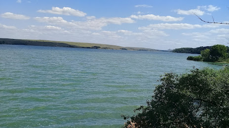
Vil'Khivs'Ke Reservoir on the map, Zuhres, Donetsk Oblast
Photo
Where is located Vil'Khivs'Ke Reservoir
Vil'Khivs'Ke Reservoir — local attraction, which is located at 3.7 km² and belongs to the category — -. Average visitor rating for this place — 4.7 (according to 56 ratings, information from open sources and relevant for 2022).
Exact location — Vil'Khivs'Ke Reservoir, marked on the map with a red marker.
You can get directions to Vil'Khivs'Ke Reservoir on the map from your location.
What else is interesting in Zuhres? You can see all the sights if you go to the city page.
Coordinates
Vil'Khivs'Ke Reservoir coordinates in decimal format: latitude — 48.073694733715804, longitude — 38.31173932318773. When converted to degrees, minutes, seconds Vil'Khivs'Ke Reservoir has the following coordinates: 48°4′25.3 north latitude and 38°18′42.26 east longitude.
Nearby cities
The largest cities that are located nearby:
- Donetsk — 34 km
- Horlivka — 37 km
- Alchevs'k — 64 km
- Luhansk — 98 km
- Taganrog
 (Russia) — 101 km
 - Bataysk (Russia) — 147 km
- Shakhty (Russia) — 150 km
- Novocherkassk (Russia) — 151 km
- Berdyans'k — 179 km
- Pavlohrad — 184 km
- Melitopol' — 255 km
- Dniprodzerzhyns'k — 273 km
- Nikopol' — 293 km
- Volgodonsk (Russia) — 298 km
- Belgorod (Russia) — 309 km
- Poltava — 318 km
- Kerch
 — 326 km
 - Krasnodar (Russia) — 334 km
- Kryvyi Rih — 361 km
Distance to the capital
Distance to the capital (Kyiv) is about — 624 km.