
 Medvezha
Mokryany
Pidhirtsi
Prymors'k
Medvezha
Mokryany
Pidhirtsi
Prymors'k  Velyka Rudka
Nemovychi
Nyzhnya Yablun'ka
Polonychi
Berezivka
Velyka Rudka
Nemovychi
Nyzhnya Yablun'ka
Polonychi
Berezivka
Kobila on the map, Rakhiv, Ukraine
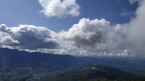
Photo
Where is located Kobila
Kobila — local attraction, which is located at 1,177 m and belongs to the category — -. Average visitor rating for this place — 3.9 (according to 7 ratings, information from open sources and relevant for 2022).
Exact location — Kobila, marked on the map with a red marker.
You can get directions to Kobila on the map from your location.
What else is interesting in Rakhiv? You can see all the sights if you go to the city page.
Coordinates
Kobila, Ukraine coordinates in decimal format: latitude — 48.03779546610181, longitude — 24.092818301010123. When converted to degrees, minutes, seconds Kobila has the following coordinates: 48°2′16.06 north latitude and 24°5′34.15 east longitude.
Nearby cities
The largest cities that are located nearby:
- Baia Mare
 (Romania) — 62 km
 - Satu Mare (Romania) — 101 km
- Chernivtsi — 130 km
- Cluj-Napoca (Romania) — 149 km
- Uzhhorod — 153 km
- Suceava (Romania) — 159 km
- Nyíregyháza
 (Hungary) — 184 km
 - Botoșani (Romania) — 187 km
- Debrecen (Hungary) — 200 km
- Oradea (Romania) — 203 km
- Piatra Neamț (Romania) — 206 km
- Košice
 (Slovakia) — 227 km
 - Sibiu (Romania) — 250 km
- Miskolc (Hungary) — 254 km
- Bacău (Romania) — 263 km
- Rzeszow
 (Poland) — 270 km
 - Iași (Romania) — 273 km
- Balti
 (Moldova) — 278 km
 - Brașov (Romania) — 285 km
Distance to the capital
Distance to the capital (Kyiv) is about — 538 km.