
 Sines
Geraz do Lima (Santa Leocádia)
Benavente
Lisbon
Lisbon
Grândola
Matosinhos
Alpedriz
Beja
Sines
Geraz do Lima (Santa Leocádia)
Benavente
Lisbon
Lisbon
Grândola
Matosinhos
Alpedriz
Beja
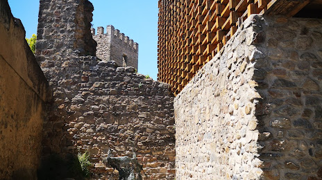
Portalegre Castle on the map, Portalegre, Portugal
Photo
Where is located Portalegre Castle
Portalegre Castle — local attraction, which is located at R. Luís Barahona 8, 7300-158 Portalegre, Portugal and belongs to the category — historical landmark. Average visitor rating for this place — 3.5 (according to 296 ratings, information from open sources and relevant for 2022).
Exact location — Portalegre Castle, marked on the map with a red marker.
You can get directions to Portalegre Castle on the map from your location.
What else is interesting in Portalegre? You can see all the sights if you go to the city page.
Coordinates
Portalegre Castle, Portugal coordinates in decimal format: latitude — 39.2909254621206, longitude — -7.430516902271484. When converted to degrees, minutes, seconds Portalegre Castle has the following coordinates: 39°17′27.33 north latitude and -7°25′49.86 east longitude.
Nearby cities
The largest cities that are located nearby:
- Badajoz
 (Spain) — 61 km
 - Coimbra — 130 km
- Amadora — 166 km
- Queluz — 169 km
- Porto — 229 km
- Huelva (Spain) — 229 km
- Salamanca (Spain) — 237 km
- Dos Hermanas (Spain) — 259 km
- Braga — 262 km
- Córdoba (Spain) — 279 km
- Jerez (Spain) — 311 km
- Móstoles (Spain) — 321 km
- Cádiz (Spain) — 323 km
- Fuenlabrada (Spain) — 325 km
- Alcorcón (Spain) — 325 km
- Leganés (Spain) — 329 km
- Getafe (Spain) — 331 km
- Madrid (Spain) — 337 km
- Ourense (Spain) — 338 km
Distance to the capital
Distance to the capital (Lisbon) is about — 161 km.