
 Belém
Maranguape
Paranaguá
Paranaguá
Monte Alegre
Alvorada de Minas
Bragança
Laguna
Ibiporã
Belém
Maranguape
Paranaguá
Paranaguá
Monte Alegre
Alvorada de Minas
Bragança
Laguna
Ibiporã
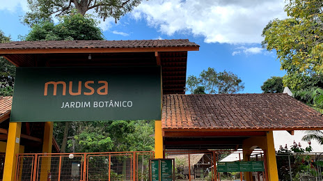
Museu da Amazônia - MUSA on the map, Manaus, Brazil
Photo
Where is located Museu da Amazônia - MUSA
Museu da Amazônia - MUSA — local attraction, which is located at Av. Margarita, 6305 - Cidade de Deus, Manaus - AM, 69099-415, Brazil and belongs to the category — open air museum. Average visitor rating for this place — 4.7 (according to 6646 ratings, information from open sources and relevant for 2022).
Exact location — Museu da Amazônia - MUSA, marked on the map with a red marker.
You can get directions to Museu da Amazônia - MUSA on the map from your location.
What else is interesting in Manaus? You can see all the sights if you go to the city page.
Coordinates
Museu da Amazônia - MUSA, Brazil coordinates in decimal format: latitude — -3.007251296240958, longitude — -59.940144393008886. When converted to degrees, minutes, seconds Museu da Amazônia - MUSA has the following coordinates: -3°0′26.1 north latitude and -59°56′24.52 east longitude.
Nearby cities
The largest cities that are located nearby:
- Santarém — 592 km
- Boa Vista — 661 km
- Porto Velho — 754 km
- Macapá — 1049 km
- Sinop — 1083 km
- Georgetown
 (Guyana) — 1115 km
 - Paramaribo
 (Suriname) — 1125 km
 - White River — 1139 km
- Marabá — 1224 km
- Belém — 1288 km
- Ciudad Bolivar
 (Venezuela) — 1298 km
 - Ananindeua — 1302 km
- Castanhal — 1353 km
- Araguaína — 1372 km
- El Tigre (Venezuela) — 1404 km
- Imperatriz — 1406 km
- Cuiaba — 1442 km
- Várzea Grande — 1446 km
- Iquitos
 (Peru) — 1461 km