
 Maureville
Samoëns
Gréning
Toulouse
Volx
Goudet
Méhoncourt
Saint-Hymer
Pontcarré
Maureville
Samoëns
Gréning
Toulouse
Volx
Goudet
Méhoncourt
Saint-Hymer
Pontcarré
Notre-Dame de la Couture on the map, Le Mans, France
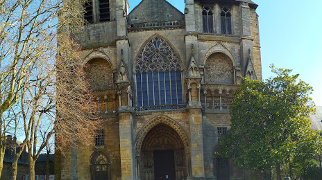
Photo
Where is located Notre-Dame de la Couture
Notre-Dame de la Couture — local attraction, which is located at 22 Rue Berthelot, 72000 Le Mans, France and belongs to the category — building. Average visitor rating for this place — 4.6 (according to 53 ratings, information from open sources and relevant for 2022).
Exact location — Notre-Dame de la Couture, marked on the map with a red marker.
You can get directions to Notre-Dame de la Couture on the map from your location.
What else is interesting in Le Mans? You can see all the sights if you go to the city page.
Coordinates
Notre-Dame de la Couture, France coordinates in decimal format: latitude — 48.002453485970356, longitude — 0.20067429801079364. When converted to degrees, minutes, seconds Notre-Dame de la Couture has the following coordinates: 48°0′8.83 north latitude and 0°12′2.43 east longitude.
Nearby cities
The largest cities that are located nearby:
- Tours — 77 km
- Angers — 82 km
- Orléans — 127 km
- Caen — 136 km
- Rennes — 139 km
- Nantes — 158 km
- Le Havre — 165 km
- Rouen — 172 km
- Boulogne-Billancourt — 175 km
- Limoges — 254 km
- Amiens — 257 km
- Eastbourne
 (United Kingdom) — 305 km
 - Reims — 309 km
- Portsmouth (United Kingdom) — 324 km
- Clermont-Ferrand — 332 km
- Bournemouth (United Kingdom) — 333 km
- Southampton (United Kingdom) — 340 km
- Crawley (United Kingdom) — 344 km
- Brest — 347 km
Distance to the capital
Distance to the capital (Paris) is about — 185 km.